
Ground Investigation Surveys
Ground Risk and P128 Utility Surveys to Inform Safe Excavation
Complete Site Investigation & Safe Excavation Solution
JCG delivers a full end-to-end service, covering ground investigations, reporting, survey drawings, and excavation methodology, through to safe exposure of services using a vacuum suction machines.
One coordinated package designed to reduce risk, improve accuracy, and support safe, compliant excavation.
Pre-Construction
Desktop Surveys & Intelligence Gathering
Eliminate the "unknowns" before your boots hit the ballast. We provide a rigorous digital audit of your site’s historical and utility data
Scope of Service:
Statutory Utility Searches & Comprehensive Asset Reporting.
Site Access Logistics & Comprehensive Planning Maps.
Pre-site Reconnaissance and Hazard Identification.
The Deliverable: A decision-ready intelligence pack including detailed utility reports and site-specific access drawings.
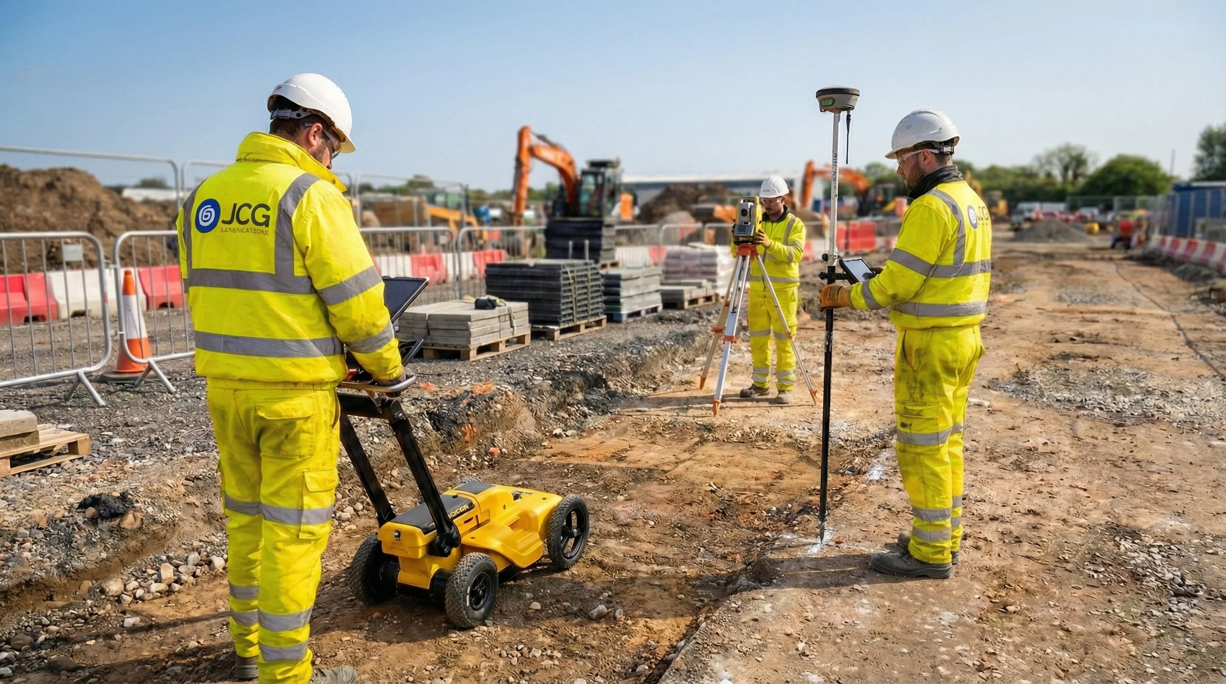
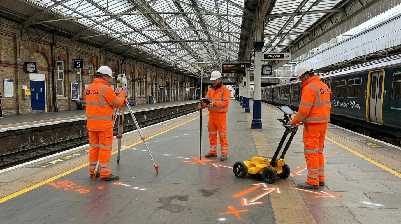
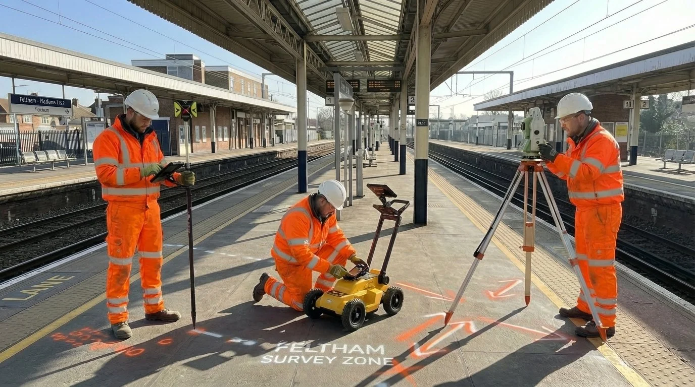
Technical Site Surveys
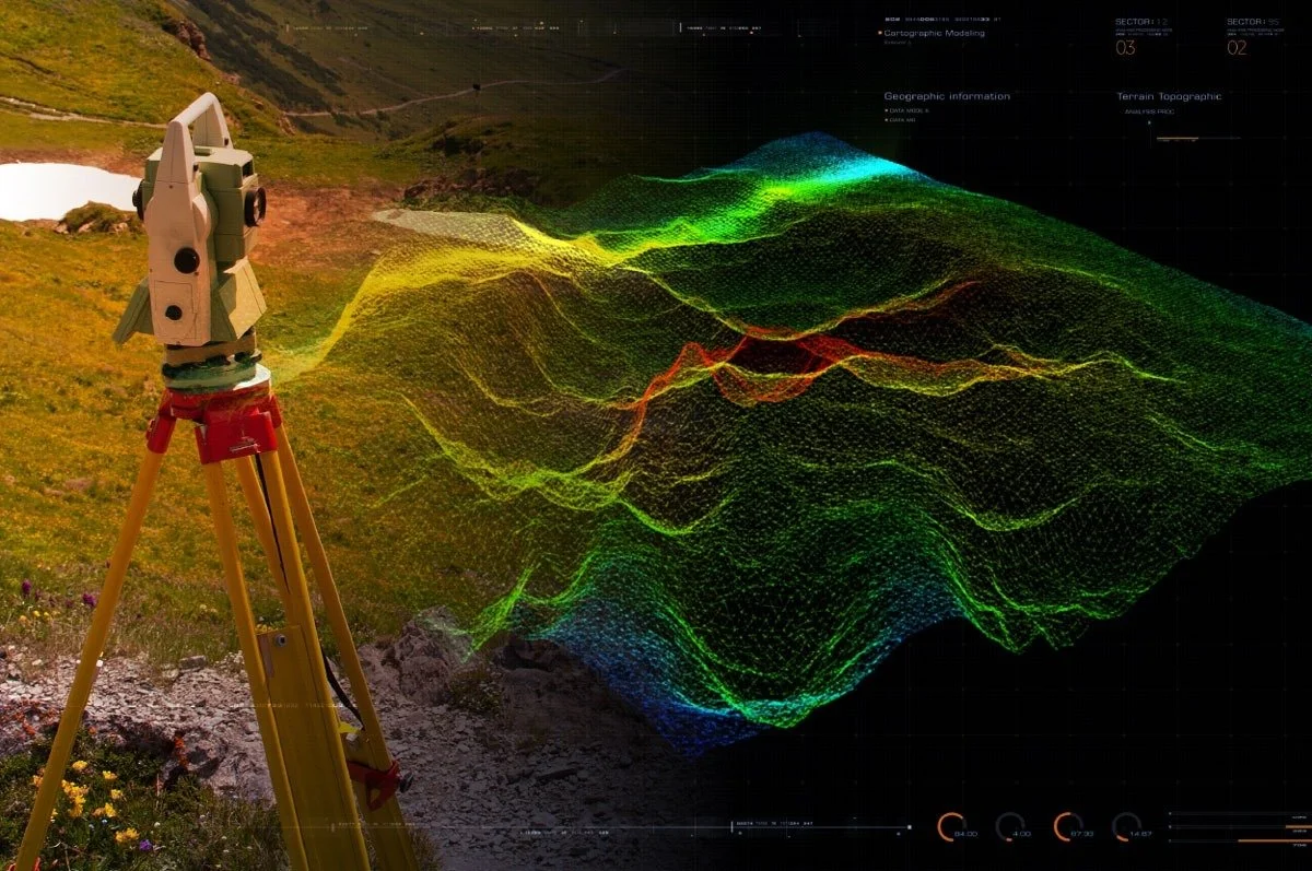
Multi-Disciplinary Site Investigation & Digital Mapping
High-precision data collection using industry-leading non-destructive technology. We translate complex site conditions into clear, actionable CAD data.
Scope of Service:
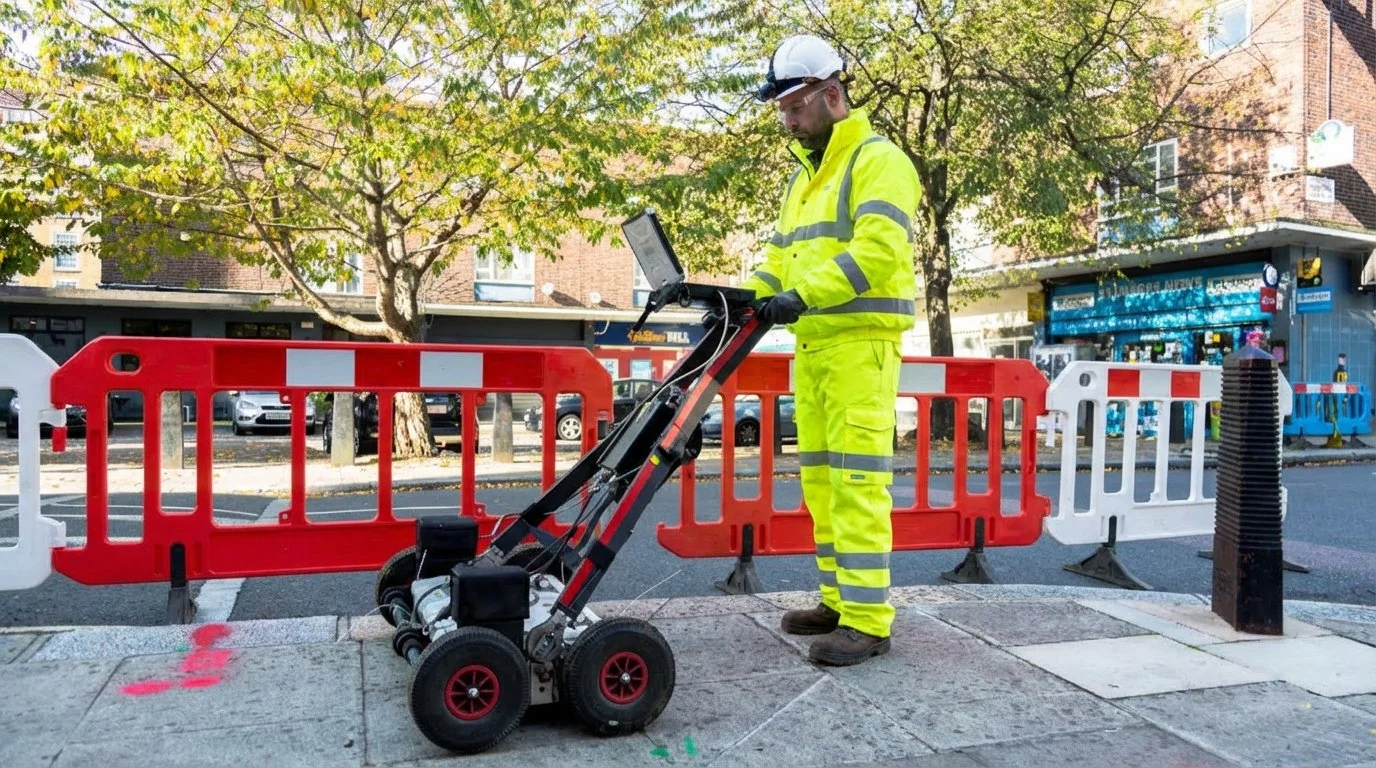
Sub-Surface Imaging: Advanced Ground Penetrating Radar (GPR) and Electromagnetic Locating (CAT & Genny).
Precision Surveying: Topographical, GPS, and Volumetric Surveys.
Geotechnical Intelligence: Trial Holes and Full Ground Investigation (GI) reports.
The Deliverable: Professional DWG/CAD drawings and comprehensive technical documentation ready for your design team.
Surveys & Excavation
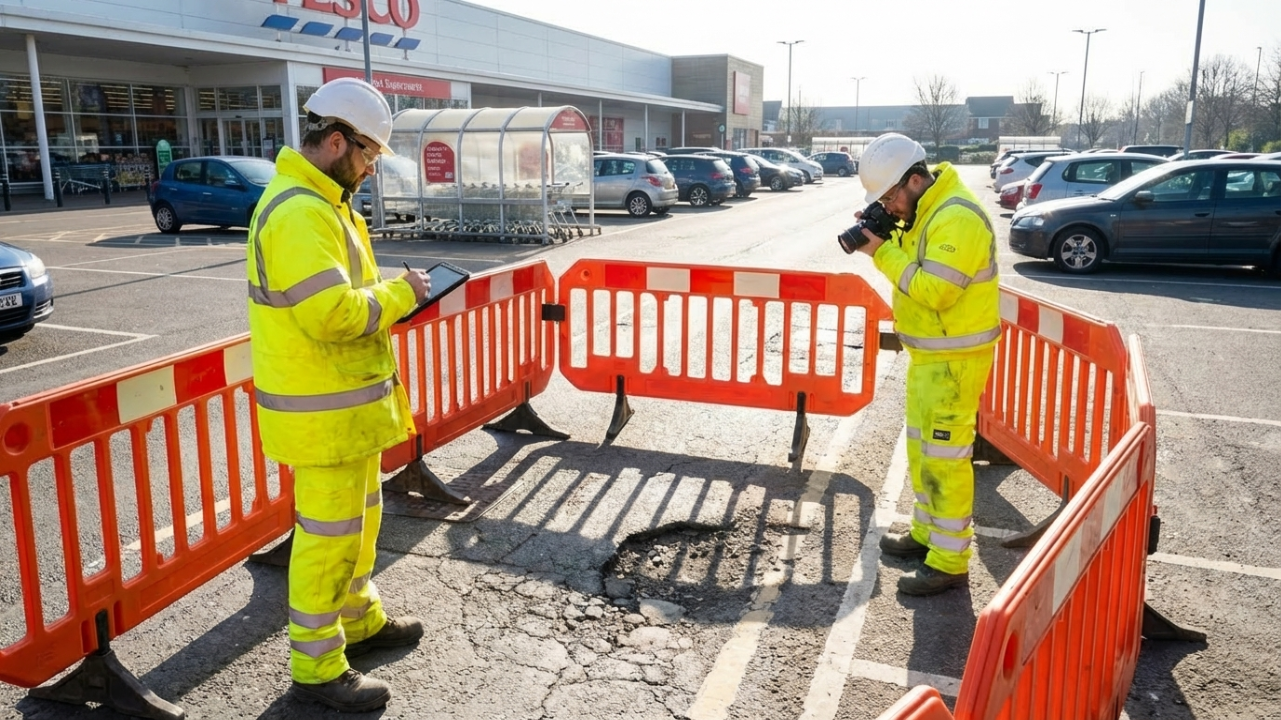
Verified Safe Excavation & Asset Exposure
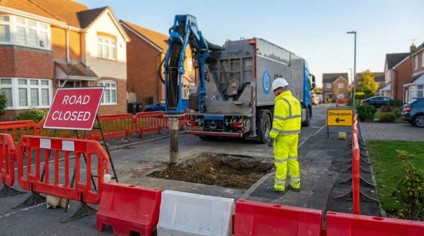
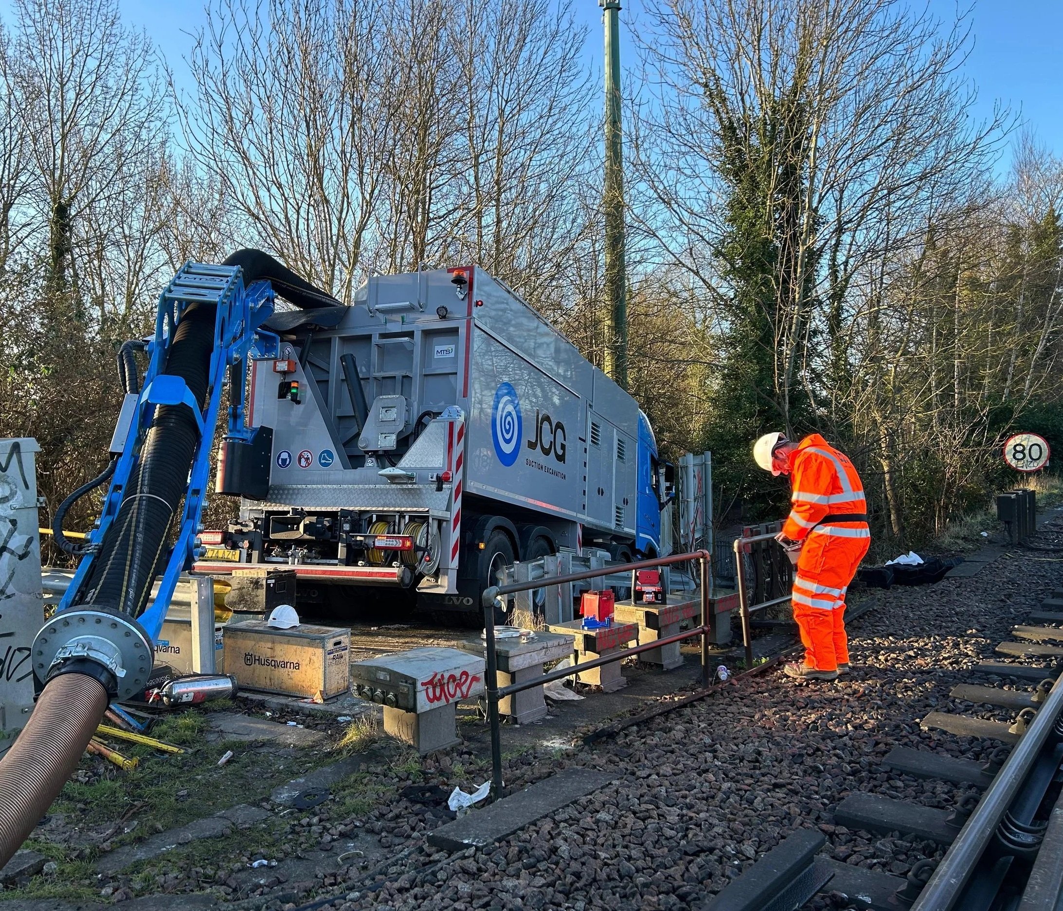
The "Gold Standard" in risk mitigation. We provide 100% physical certainty by exposing assets using safe, non-invasive vacuum suction excavation.
Scope of Service:
Vacuum Suction Excavation: Controlled, high-volume debris removal with zero mechanical risk to buried services.
Physical Asset Verification: Visual confirmation of utility depth, type, and condition.
Controlled Safe Digging: Precise excavation in high-density utility corridors and restricted rail environments.
The Deliverable: A "Verified Safe" certificate and high-resolution photographic evidence of exposed assets.
Survey Services We Provide
-
Desktop Surveys
A PAS 128 desktop study provides a cost-effective, all-in-one utility overview for your site. Includes PAS 128 Statutory Pack (Type D).
Early input to support feasibility, planning, and survey scoping before intrusive works commence. This includes the identification of potential buried risks and constraints that may affect the excavation strategy.
-
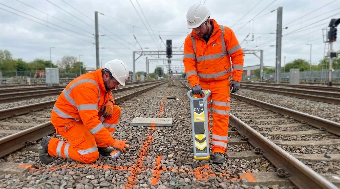
Utility Detection
Detection and tracing of live services to inform safe excavation planning, service avoidance, and compliance with HSG47. Using equipment such as a CAT & Genny.
Our engineer can spray clear markings on-site and produce CAD drawings of the utilities found.
-
Integrated GPR Surveys
Ground Penetrating Radar (GPR) is a versatile tool which can be used to meet a range of objectives:
Combined detection methodologies for congested, urban, or high-risk environments where electromagnetic detection alone is insufficient. Surveys are planned and interpreted in line with PAS 128 requirements.
-
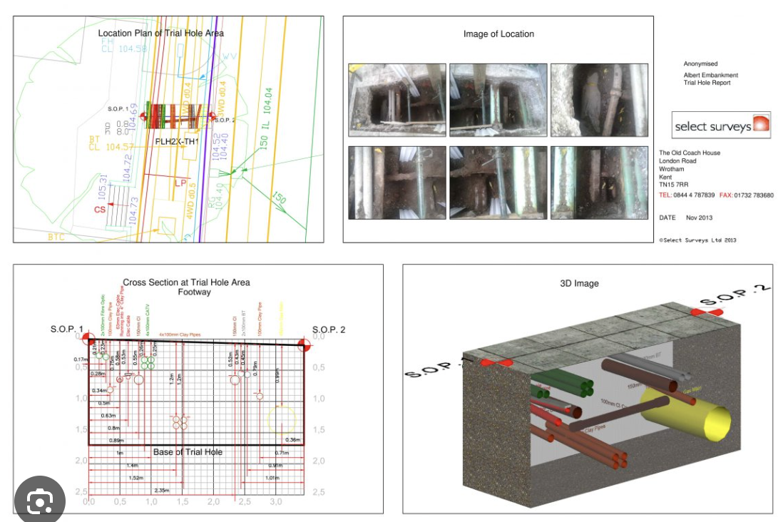
Trial Hole Surveys
Trial holes physically confirm the position, depth, and type of underground services identified in PAS 128 surveys and utility records.
Excavation is carried out using safe digging methods in line with HSG47, reducing utility strike risk and removing design uncertainty before construction.
-
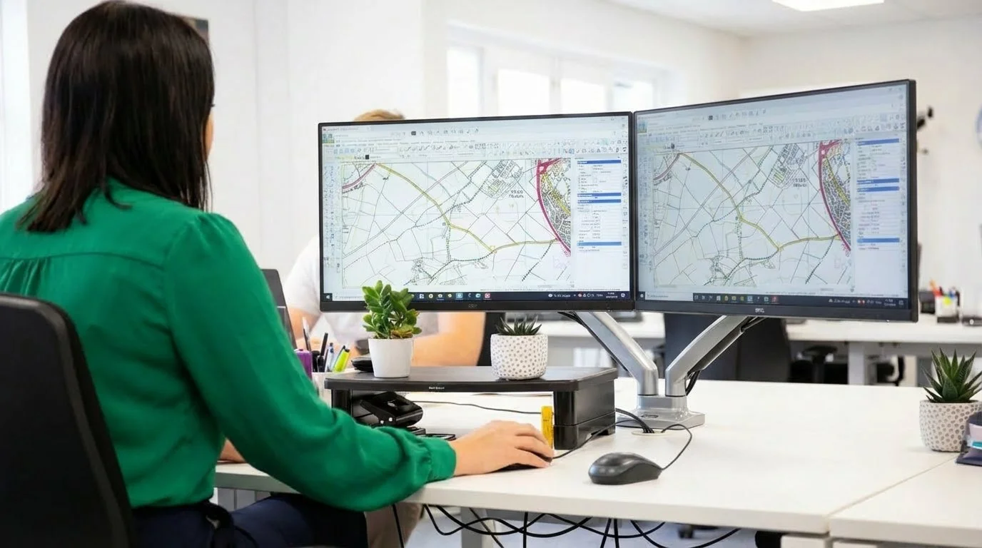
Topographical Survey (inc Buried Services)
A detailed topographical survey capturing site levels, features, and infrastructure, combined with detected underground utilities into one coordinated CAD drawing.
Provides designers and contractors with a complete view of site constraints to support planning and safe excavation in line with PAS 128 and CDM requirements.
-
Dilapidation Survey Report
A pre-works condition survey recording the state of nearby structures, roads, and assets before construction begins.
Photographs and written records provide a baseline to manage risk, protect stakeholders, and avoid disputes related to excavation or vibration impact.
Difficult Project? No Problem…
-
Targeted Detection in Sensitive Areas
We provide focused, non-invasive surveys around critical structures, foundations, and complex work areas in full alignment with PAS 128 industry standards. Our expert interpretation reflects practical site constraints and operational interfaces, ensuring that all buried assets are accurately identified before work begins. This strategic detection is essential for maintaining safety and compliance in sensitive or high-risk environments.
-
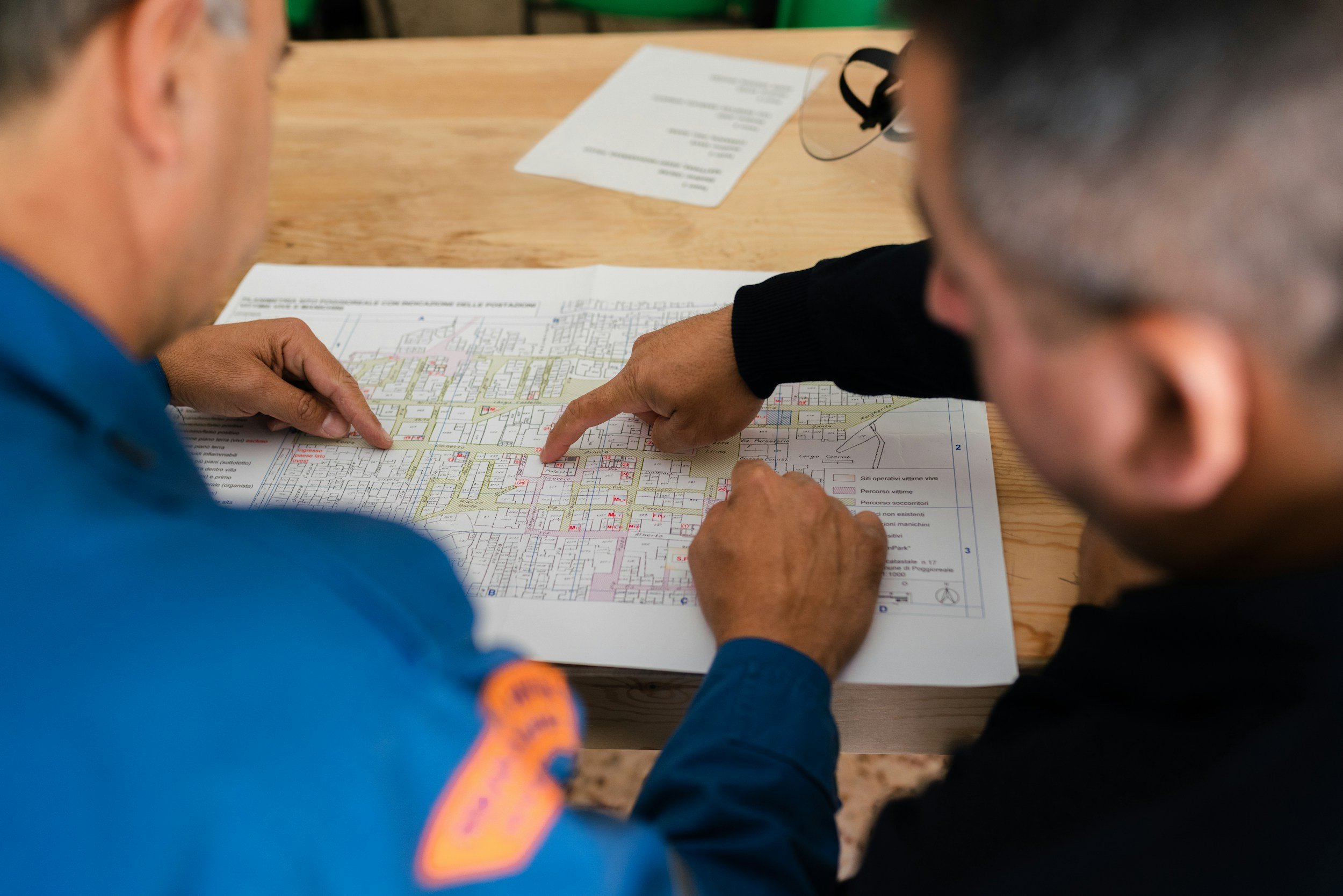
Strategic PCIP & CDM Advisory Support
We offer specialist advisory support to help Principal Designers and Contractors develop the Pre-Construction Information Pack (PCIP). Our team identifies where verification works, such as trial holes or vacuum excavation, must be prioritised to reduce ground uncertainty. By integrating our findings with CDM 2015 Regulations, we help manage project risks without undertaking unnecessary excavation as part of the initial survey scope.
-
Emergency & Short-Notice Surveys
JCG delivers rapid investigation support for unplanned ground risks, suspected service conflicts, or urgent works that demand immediate action under Health and Safety Regulations in Construction. Delivered on a best-endeavours basis within defined scope boundaries, our emergency surveys ensure that your site remains compliant and that personnel are protected from unforeseen hazards during high-pressure, short-notice operations.
We provide PAS 128 utility and ground risk surveys across the South East
The Complete Site Delivery Package
Every project includes:
Site visits & factual survey reports
PAS 128 classification
Marked-up drawings and findings
Safe vacuum suction excavation to the plan and methodology
We collaborate with frameworks to ensure all projects are surveyed

Ground Investigation Surveys By JCG
30+ years of construction experience
-
When Ground Investigation Surveys Are Appropriate
Our survey services are appropriate where early understanding of buried risk is required to inform planning, design development, or safe excavation strategies. This includes feasibility stages, pre-construction planning, congested or high-risk environments, and situations where verification works need to be targeted and proportionate.
Comprehensive ground surveys are a critical requirement of the Pre-Construction Information Pack (PCIP), ensuring full compliance with CDM 2015 Regulations and framework safety standards.Surveys are intended to reduce uncertainty, support decision-making, and inform subsequent verification or excavation activities.
-
When Ground Investigation Surveys Are Not Appropriate
Surveys should not be relied upon as confirmation that an area is free from buried services or hazards. They are not a substitute for verification, trial holes, or excavation, and should not be used where absolute certainty or clearance is required.
Detection results are subject to known limitations, site conditions, and access constraints, all of which are clearly stated within our reports.
Speak to the Team
Contact us to discuss survey requirements or to obtain early ground risk support before excavation works begin.